数字地形图规则图形正则化处理程序设计与开发毕业论文
2020-04-25 19:41:35
摘 要
测绘顾名思义,即是测量与绘图。用全球导航卫星定位系统(GNSS)、遥感(RS)、地理信息系统(GIS)等技术核心,通过计算机网络通讯技术、空间和信息科学等基础,用测量手段取得地面已知的特征点与界线,从而的到反映地面实际情况的图形以及位置信息,用作工程建设的规划设计以及行政管理。随着时代的发展,计算机行业崛起,并向各个领域的渗透,测绘也开始向数字化方向发展。包括全站仪、RTK等的使用,由此,数字化测图也越来越被各测绘行业认可并使用。但是由于测图过程中会出现各种误差,导致测出的地形图不符合实际情况。通常通过正则化处理来解决这一系列问题。本课题主要对以下三个方面进行研究:
1.针对数字地形图类型不同的规则图形地物研究其不同的正则化标准及处理方式。
2.数字地形图规则图形地物在AutoCAD中以DXF格式保存文件后,研究DXF格式下规则地物的属性表示方式及其编辑修改方式。
3.通过 Visual Basic 平台设计开发程序来实现数字地形图规则图形地物的正则化处理。
通过本课题的研究,实现了基于 AutoCAD 数字地形图中规则地物的正则化处理程序,不符合关系的规则地物进行自动处理,从而提高数字测图的效率。
关键词:数字地形图 正则化处理 DXF文件
Digital topographic map rule graphics regularization processing research program design and development
Abstract
Surveying and mapping is measuring and drawing. With computer technology, photoelectric technology, network communication technology, space science, information science as the foundation, with the global navigation satellite positioning system (GNSS), remote sensing (RS), geographical information system (GIS) as the core technology, the existing feature points on the ground and boundary reflect the current state of the ground were obtained through the measurements of the graphics and location information, for the planning and design of engineering construction and administration. With the continuous progress of science, the rise of the computer industry and the penetration of various fields, surveying and mapping also began to develop towards the digital direction. Including the use of total station instrument, RTK, etc., therefore, digital mapping is increasingly recognized and used by the surveying and mapping industry. However, due to various errors in the mapping process, the measured topographic map does not conform to the actual situation. Regularization processing is usually used to solve this series of problems.This subject mainly studies the following three aspects:
1. Study different regularization standards and processing methods for regular graphic features with different types of digital topographic maps.
2. After saving files in DXF format in AutoCAD, the property representation and editing and modification methods of regular ground objects in DXF format were studied.
3. Through the Visual Basic platform design and development program to realize the regularization processing of digital topographic map rules and graphic features.
Through the research of this subject, a regularization processing program based on AutoCAD for regular ground objects in digital topographic maps is designed, and the regular ground objects that do not conform to the relationship are processed automatically, so as to improve the efficiency of digital mapping.
Key Words:Digital topographic map;Regularization;DXF file read and write;VB
目录
摘要 I
Abstract II
第一章 绪论 2
1.1 研究背景 2
1.2 国内外研究现状 2
1.3 研究内容 3
第二章 数字地形图规则图形正则化处理 4
2.1 数字地形图的质量控制 4
2.1.1 地理精度控制 4
2.1.2 数学精度控制 4
2.1.3 整饰质量控制 5
2.2 误差来源分析 5
2.2.1操作误差 5
2.2.2仪器误差 5
2.2.3图幅定向误差 5
2.3 数字地形图自动检查 6
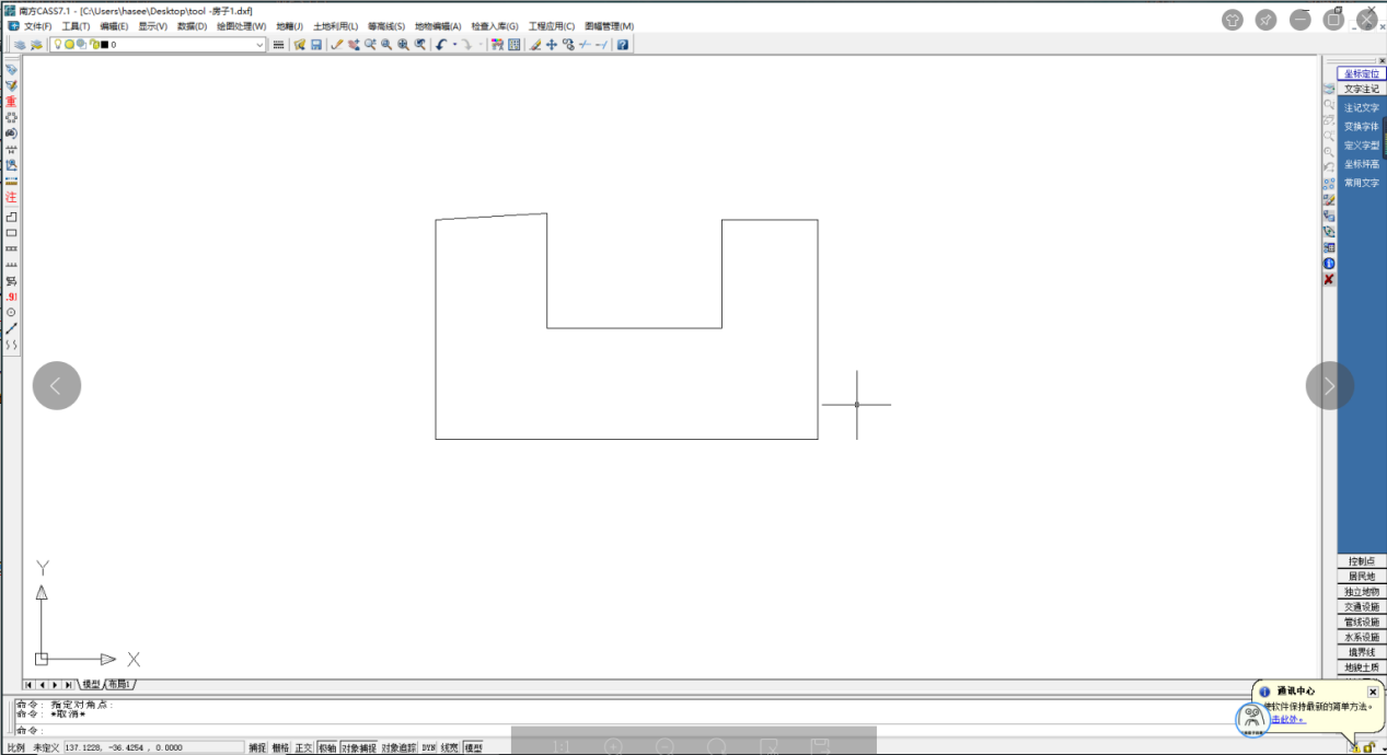
2.4 地形图正则化 6
2.4.1 方形建筑物的纠正 7
2.4.2 圆形建筑物的纠正 9
2.4.3 线状建筑物的纠正 11
第三章 基于DXF文件格式的数字地形图结构分析 12
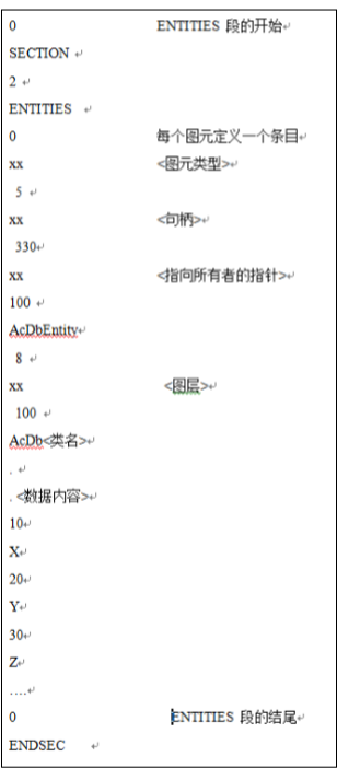
3.1 DXF文件的基本结构 12
3.2 DXF文件的组码 14
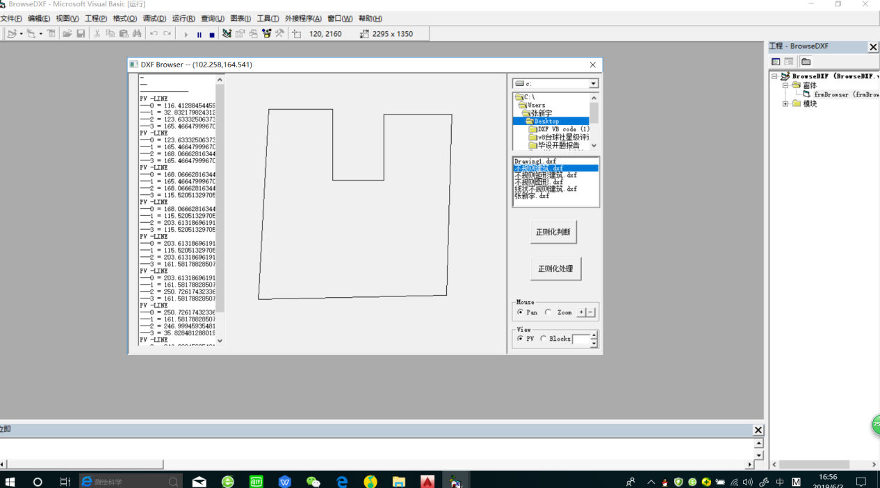
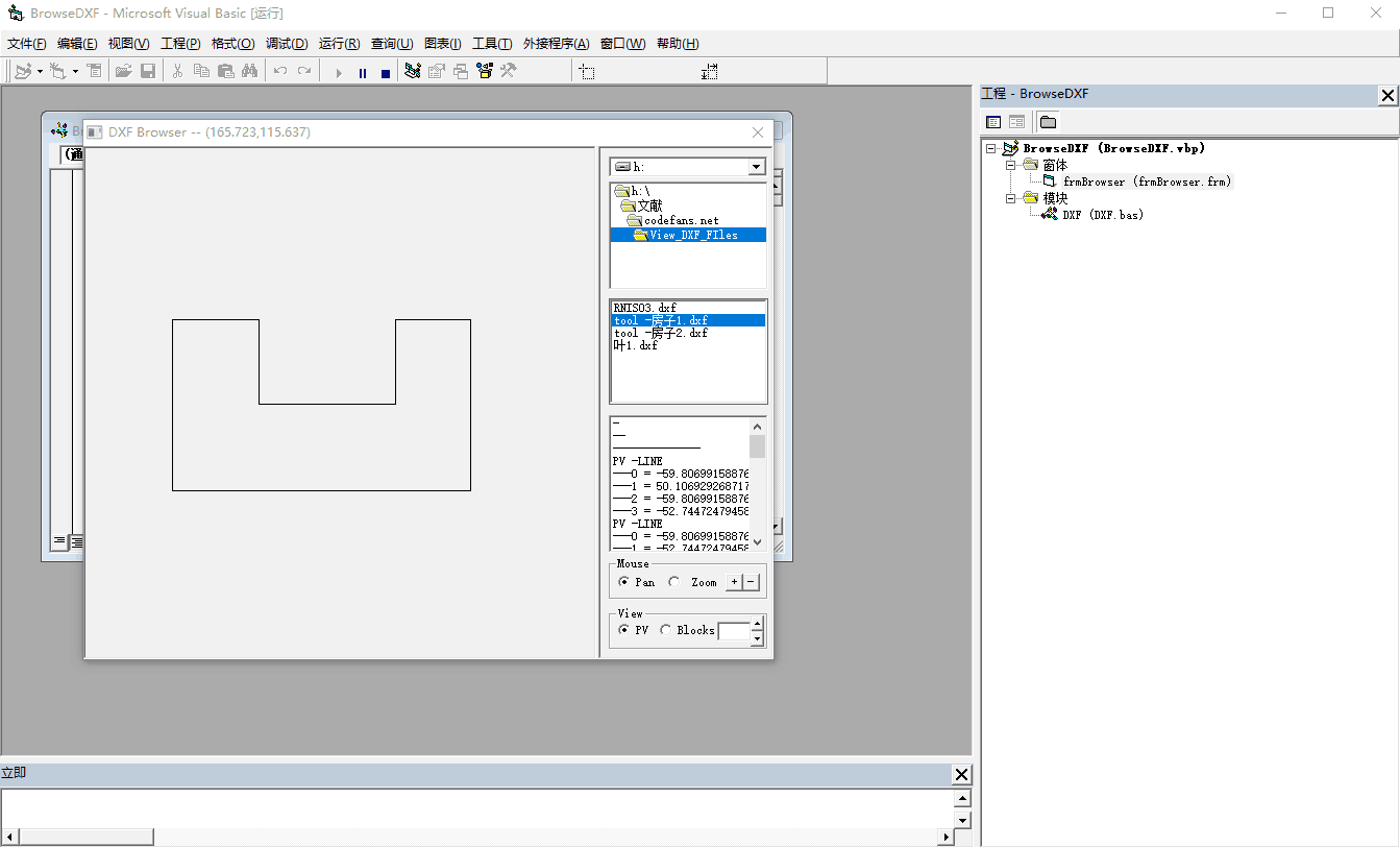
3.3 规则图形在DXF格式下的读写 14
3.3.1 读取方式 14
3.3.2 写入方式 16
第四章 编程的设计与实现 18
4.1 VB开发环境 18
4.2 程序实现的功能 18
4.3 程序可行性分析 19
4.3.1技术可行性 19
4.3.2经济与社会环境可行性 19
4.4 编程实现 19
4.4.1规则图形正则化处理 20
4.4.2线状建筑物正则化处理 22
第五章 总结与展望 24
5.1总结 24
5.2 展望 24
参考文献 25
致谢 26
附录 27
第一章 绪论
1.1 研究背景
随着科学的不断发展,人们对地理,地形信息也有了越来越高的需求,在测绘行业中,计算机技术也得到了更多普及与应用,测绘产品也由先前的模拟纸质地形图向数字地形图方向做了巨大的转变。自从数字地形图产品诞生,就在军事指挥,作战演习和经济建设等众多领域发挥着不可替代的作用。因此数据成果质量的好坏,对任务是否能顺利有序的开展,起着至关重要的作用。数字地形图要素是按照数据的获取和成图的方法不同,区分为矢量数据和栅格数据。由于栅格格式的数字图不能编辑修改,使用不方便,所以对于栅格格式的地形图,一般情况都将其转化为矢量格式的数字地形图。对于数字地形图来说,具有较高的数据质量来对减少误差的影响是数字测图质量的重要依据,如何获得高质量的数字地形图数据或者是对数字地形图数据进行检查改正来提高数据的质量,是测绘界共同关注的焦点问题。解决好这个问题,对于现实中的测绘工作有着深远的意义和影响。本文着重从数字地形图的质量控制内容,和质量检查以及误差来源分析入手,对数字地形图规则图形正则化处理进行论述。
1.2 国内外研究现状
相关图片展示:

您可能感兴趣的文章
- 南京市地上电力线、通信线调查与入库开题报告
- 徕卡TM30测量机器人ATR性能分析开题报告
- 倾斜摄影测量技术在道路规划中的应用研究外文翻译资料
- 基于无人机高光谱遥感的水体浊度反演外文翻译资料
- 利用美国印第安纳波利斯市的景观格局指数评估土 地利用和土地覆被模式对热环境的影响外文翻译资料
- 低成本、高精度、单频GPS-BDS RTK定位外文翻译资料
- 数据缺口环境下基于自回归模型的GNSS/INS松耦合集成外文翻译资料
- Loam_livox:一种适用于小视场激光雷达的快速、鲁棒、高精度的激光雷达里程计和建图软件包外文翻译资料
- 基于对IMU与GNSS融合数据的质量评价实现在无人机映射条件下的地理配准外文翻译资料
- 色彩在回族建筑中的研究与应用外文翻译资料


