现代测绘方法发展趋势的探讨毕业论文
2020-04-23 20:10:23
摘 要
测绘技术在随着科技不断的进步,在学科理论、技术水平和应用范围三方面得到巨大改变。现代测绘方法颠覆了传统方法测量范围的局限性、测量方式的繁琐性、测量结果的粗略性与测量工作的耗资性,遥感技术、航空技术、测绘软件研发技术的不断进步,对测绘行业的作业的范围、速度、成果有了极大的帮助,有效地保障了民用建设和军事建设的需求。对现代测绘方法的研究,可以帮助人们对自然环境进行探索与研究,可以帮助人们对自然现象进行解释,还促进社会发展。测绘方法的飞速发展正带动测绘行业的飞速发展,本文就现代测绘方法,遥感技术、航空摄影测量技术、无人机技术和测绘软件的发展现状以及它们的发展趋势进行了阐述。
关键词: 现代测绘方法 现状 发展 趋势
Discussion on the Development Trend of Modern Surveying and Mapping Method
Abstract:
With the continuous progress of science and technology, surveying and mapping technology has undergone tremendous changes in subject theory, technology level and application scope. Modern surveying and mapping methods overturn the limitations of traditional methods in measuring scope, the complexity of surveying methods, the roughness of measuring results and the cost of surveying work. The continuous progress of remote sensing technology, aviation technology and surveying and mapping software development technology has greatly helped the scope, speed and results of Surveying and mapping industry, effectively guaranteeing the needs of civil and military construction. Studying modern mapping methods can help people explore and study the natural environment, help people explain natural phenomena and promote social development. The rapid development of surveying and mapping methods is driving the rapid development of the surveying and mapping industry.This paper describes the development of modern surveying and mapping methods, remote sensing technology, aerial photographer technology, UAV technology and surveying and mapping software and their development trends.
Key Words: modern surveying and mapping methods;Present situation;development;trend
目录
摘要: I
Abstract: II
第一章引言 1
1.1 研究背景 1
1.2 研究对象 1
1.3 研究方向与方法 1
第二章现代测绘的发展现状以及作用 2
2.1现代测绘的发展 2
2.2测绘地理信息辅助城市化信息管理 2
2.2.1 测绘地理信息是城市建设中应用的基础性技术信息 2
2.2.2 测绘地理信息促进城市建设智能化发展 3
2.2.3 测绘地理信息是城市建设中开展智能化服务的重要工具 3
2.2.4 测绘地理信息促进城市建设智能决策 3
2.2.5 推动城市的多功能发展 3
2.3 测绘新技术的出现对测绘学科发展的影响 4
第三章现代测绘方法发展应用与现状 5
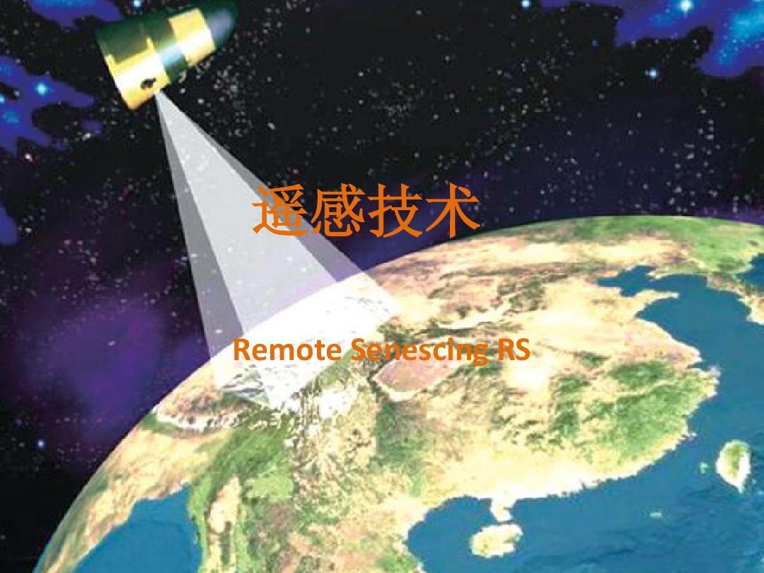
3.1遥感技术 5
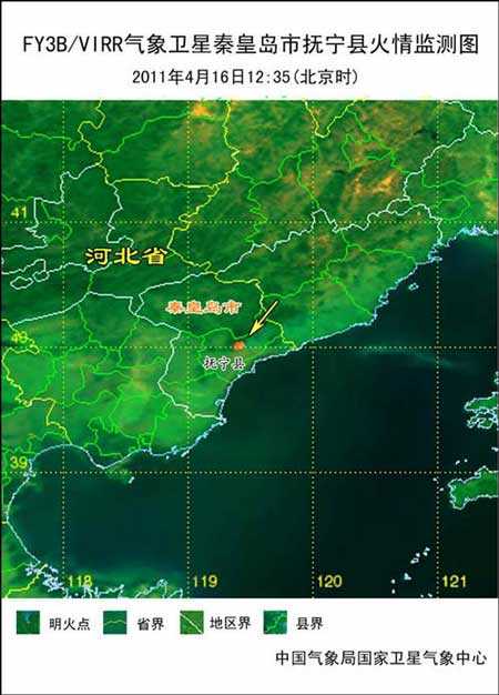
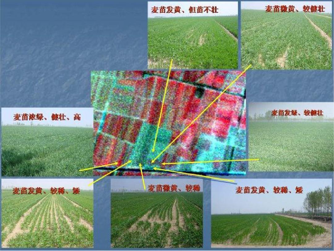
3.1.1遥感技术的发展 5
3.1.2遥感技术的应用 5
3.1.3遥感技术的现状 8
3.2现代航空摄影测量 8
3.2.1航空摄影测量的发展 8
3.2.2 航空摄影的应用 8
3.2.3航空摄影测量的现状 9
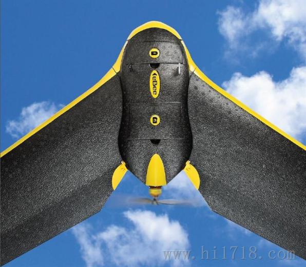
3.3无人机测量 10
3.3.2无人机测量的优缺点 10
3.3.1无人机测量现状 11
3.4测绘软件的发展 12
3.4.1 Auto CAD在工程测绘中的应用 12
3.4.2 Auto CAD的优点 12
3.4.3测绘软件的发展现状 13
第四章发展趋势 14
4.1 遥感方面趋势 14
4.2航空摄影测量方面 14
4.3 无人机方面 14
4.4 软件方面 15
第五章结束语 16
5.1测绘方法现状总结 16
5.2 测绘方法发展展望 16
参考文献 18
致谢 20
第一章 引言
1.1 研究背景
随着经济实力的日渐增长,综合国力的不断增强,再加上科学技术的研究深入,测绘发展也相应有所改变,发展领域也变得丰富起来。测绘结合现代计算机技术,信息传递技术,空间数据处理技术,运用遥感、地理信息系统等核心技术,通过测量手段测量地面地物信息,然后通过处理成图,获取地面图形和位置信息,对这些信息处理,用于工程建设的规划与行政管理。近些年来,数字化测绘产品的需求量随着社会发展需要不断增多。测绘方法发展会直接影响到社会发展,所以本文就计算机科学发展结合遥感技术、航空摄影测量、无人机测量与测绘工程软件的发展现状,对现代测绘方法发展趋势做讨论和研究。
1.2 研究对象
相关图片展示:


您可能感兴趣的文章
- 南京市地上电力线、通信线调查与入库开题报告
- 徕卡TM30测量机器人ATR性能分析开题报告
- 倾斜摄影测量技术在道路规划中的应用研究外文翻译资料
- 基于无人机高光谱遥感的水体浊度反演外文翻译资料
- 利用美国印第安纳波利斯市的景观格局指数评估土 地利用和土地覆被模式对热环境的影响外文翻译资料
- 低成本、高精度、单频GPS-BDS RTK定位外文翻译资料
- 数据缺口环境下基于自回归模型的GNSS/INS松耦合集成外文翻译资料
- Loam_livox:一种适用于小视场激光雷达的快速、鲁棒、高精度的激光雷达里程计和建图软件包外文翻译资料
- 基于对IMU与GNSS融合数据的质量评价实现在无人机映射条件下的地理配准外文翻译资料
- 色彩在回族建筑中的研究与应用外文翻译资料


