志愿者地理信息数据质量分析--以南京地区OSM为例毕业论文
2020-04-15 20:24:21
摘 要
通过志愿者更新的地理信息数据是志愿者地理信息数据,其质量不明,对VGI的广泛应用有显著影响,所以亟需解决的就是数据质量精度不高。本文在参考数据评价方法的准则上,探讨了与志愿地理信息相关的重点和研究内容,将数据完整性和几何位置精度作为评估要点,并说明了这两个质量因素的含义。为了评估数据的完整性,提出了比较两种数据在数量上的差别的几何数据完整性评估和对比属性信息的正确以及完整性属性数据完整性评估; 为了评估几何数据的精度,提出了度量空间位置精确程度的评估方案。最后,通过与百度地图和电子地图数据作比,以南京开放街道地图数据为例,展开实验。最终可知,南京市开放街道地图数据完整性精度略低,但是,几何数据的数据质量相对较高,能够成为数据来源。
关键词:志愿者地理信息 OpenStreetMap 数据质量 南京市
Volunteer Geographic Information Data Quality Analysis: A Case Study of OSM in Nanjing
Abstract
The geographic information data updated by volunteers is volunteer geographic information data, whose quality is not clear, which has a significant impact on the wide application of VGI, so it is urgent to solve the problem that the accuracy of data quality is not high. Based on the method of reference data evaluation, this paper discusses the key points and research related to volunteer geographic information, takes data integrity and geometric data accuracy as the factors of quality evaluation, and explains the meaning of these two quality factors. In order to evaluate the integrity of data, the integrity evaluation of geometric data, the correctness of attribute information and the integrity evaluation of attribute data are compared. In order to evaluate the accuracy of geometric data, an evaluation scheme to measure the accuracy of spatial location is proposed. Finally, by comparing with Baidu map and electronic map data, the experiment is carried out with Nanjing open street map data as an example. Finally, it can be seen that the accuracy of data integrity of Nanjing Open Street Map is slightly lower, but the accuracy of geometric data is relatively high, and it can be used as a renewal data source of basic geographic information.
Key words: Volunteer Geographic Information; OpenStreetMap; Data Quality; Nanjing City
目 录
摘要 I
Abstract II
目录 III
第一章 绪论 1
1.1课题研究背景及意义 1
1.2研究现状 2
1.3 研究内容 2
1.4 论文组织结构 3
第二章 OpenStreetMap概述 4
2.1 OSM介绍 4
2.1.1开放街道地图 4
2.1.2相关技术 4
2.2 OSM数据质量概述 5
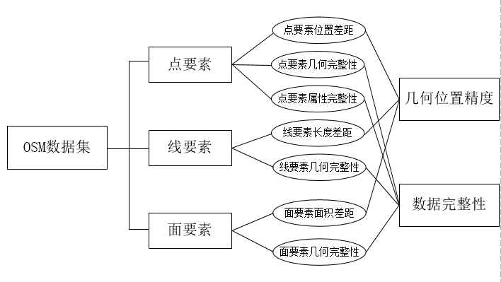
2.2.1 数据完整性 6
2.2.2 几何位置精度 6
2.3 本章小结 6
第三章 VGI数据质量分析方法 7
3.1质量分析计算模型 7
3.1.1数据完整性 7
3.1.2几何位置精度 8
3.2要素比对方法 9
3.2.1点要素比对 9
3.2.2线要素比对 9
3.2.3面要素比对 10
第四章 样区数据下载和处理 12
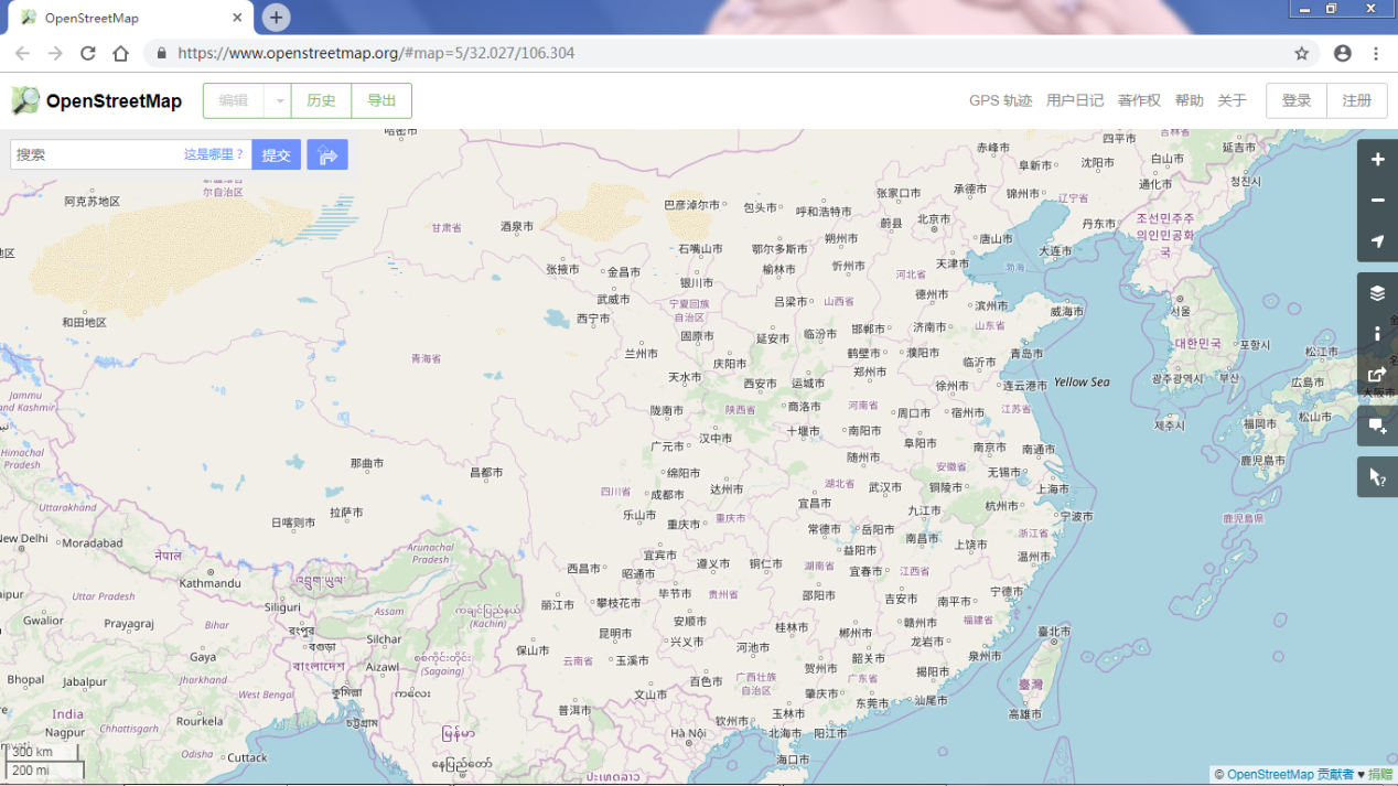
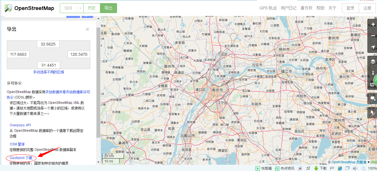
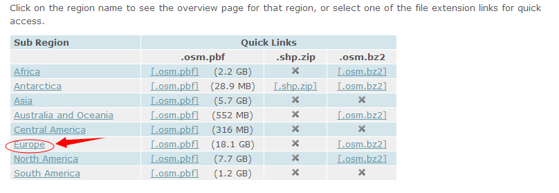
4.1 OSM数据下载 12
4.1.1南京市OSM数据下载 13
4.1.2数据的预处理 16
4.2 样区选取介绍 18
4.3参考地图数据选取 19
第五章OSM数据质量评估 21
5.1几何位置精度对比 21
5.1.1 POI定位精度对比 21
5.1.2线要素精度评估 22
5.1.3面要素精度评估 23
5.2数据完整性对比 24
5.2.1几何数据完整性 24
5.2.2属性数据完整性 24
5.3评估结果 25
第六章 总结与展望 27
6.1总结 27
6.2展望 27
参考文献 29
致谢 31
绪论
本章介绍了志愿者地理信息的研究缘由、价值,接着归纳汇总志愿者地理信息的发展状况,最后提出本文的研究内容。
1.1课题研究背景及意义
2007年Goodchild提出了志愿者地理信息(Volunteered Geographic Information,VGI)的概念[10],阐述了在Web2.0环境下,地理信息协作生产和传播共享的问题[3],用户通过在线协作的方式,以普通手持GPS终端、开放获取的高分辨率遥感影像以及个人空间认知的地理知识为基础参考,创建、编辑、管理、维护的地理信息,使得测绘模式从"按规范测量"开始转变为"按需求测量",使得空间数据实时在线更新成为可能[8]。由于志愿者地理信息数据大部分来自志愿者上传的数据,因此数据质量问题成为志愿者地理信息研究的核心内容。
Open Street Map是一个目标是创造一个内容自由且能让所有人编辑的世界地图的网上地图协作计划 [14]。OSM地图出现一直到现在,用户越来越多,仅截至到2013年统计的数据就己经达到一百万[11],且其中约30%的用户至少都在地图中提供了一个准确的地点,甚至美国苹果公司都将OSM地图嵌入iPhone中,成为苹果公司的地图数据源之一[12]。
以上是毕业论文大纲或资料介绍,该课题完整毕业论文、开题报告、任务书、程序设计、图纸设计等资料请添加微信获取,微信号:bysjorg。
相关图片展示: