天山典型区积雪信息精细分类毕业论文
2020-04-15 18:10:29
摘 要
积雪作为地表类型中极其活跃且多变的自然要素之一,随着水分、能量的再释放,积雪的状态及其类型也不断的改变。因此,积雪在全球与局部地区气候影响中起着至关重要的作用。季节性积雪是我国干旱、半干旱地区河流的重要补给,提供了宝贵的淡水资源。因此利用卫星遥感技术获取和定量识别积雪的类别信息,对研究消融期雪盖时空变化特征,融雪径流模型、雪水资源原理具有重要意义。
本文以天山玛纳斯河流域为研究区域,使用Landsat-8卫星遥感影像数据以及ASTER GDEM先进星载热辐射和反射仪全球数字高程模型,通过影像精细预处理、样本选取,利用CART算法构建专家决策树,最终实现对雪盖的精细分类(新雪、陈雪、冰、阴影区以及非雪),结合高分影像数据对分类的精度评定结构表明分类精度可达90%以上;此外还对分类后各积雪类型的特征进行后续分析,总结NDSI、NIR以及SWIR对积雪类型的影响;将决策树用于消融期多时段遥感图像的雪盖分类,以探究消融期雪盖类型时空变化特征。
关键词:积雪精细分类 Landsat-8 天山玛纳斯河流域 决策树构建 光学遥感
Sophisticated classification of satellite snow cover in TianShan typical area based on CART decision tree algorithm
Abstract
Snow cover is one of the most active and changeable natural elements in the surface type. Because its state and type change is accompanied by the storage and re-release of energy and water, snow cover plays a crucial role in global and local climate impacts. Seasonal snow cover is an important supply of rivers in arid and semi-arid regions of China, providing valuable fresh water resources. Therefore, it is a great significance for the study of temporal and spatial variation characteristics of snow cover, snowmelt runoff model and snow water resource principle during the ablation period by using the satellite remote sensing technology to obtain and quantitatively identify the category information of snow cover.
In TianShan Manas River basin as the study area, this paper uses Landsat 8 satellite remote sensing image data and the ASTER GDEM advanced satellite borne thermal radiation and reflection of the global digital elevation model. Through the image preprocessing, sample selection, using the CART algorithm to build the expert decision tree, finally realizes the fine classification of snow cover (new, old snow, ice, shadow and no snow). Combined with GF image data of the precision of classification evaluation, the classification accuracy of snow cover can reach more than 90%. In addition, the characteristics of the snow cover types after classification were analyzed, and the effects of NDSI, NIR and SWIR on the snow cover types were summarized. Decision tree was used to classify snow cover of remote sensing images in multiple time periods during ablation to explore the spatio-temporal variation characteristics of snow cover types during ablation.
Key Words: Sophisticated classification of snow cover; Landsat 8; TianShan Manas River basin; Decision tree; Optical remote sensing
目 录
摘 要 I
Abstract II
第一章 引言 1
1.1 项目研究背景与依据 1
1.2 国内外研究进展 1
1.2.1 国外研究进展 1
1.2.2 国内研究进展 3
1.3 论文切入点 4
1.4 研究内容与技术路线 4
1.4.1 研究内容 4
1.4.2 技术路线 5
第二章 研究区与数据介绍 7
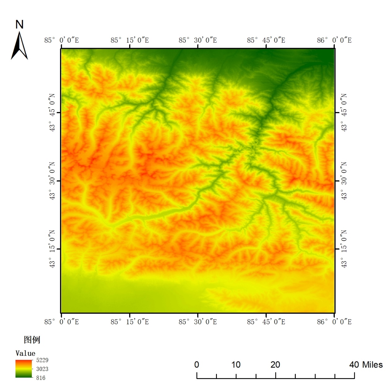
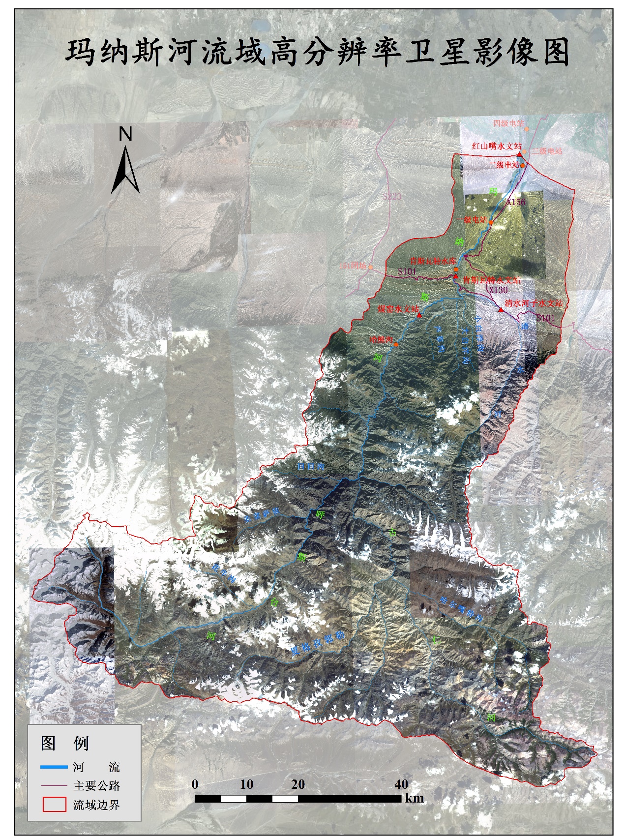
2.1 研究区现状 7
2.2 数据资料 7
2.2.1 Landsat-8卫星遥感影像数据 7
2.2.2 地形数据 8
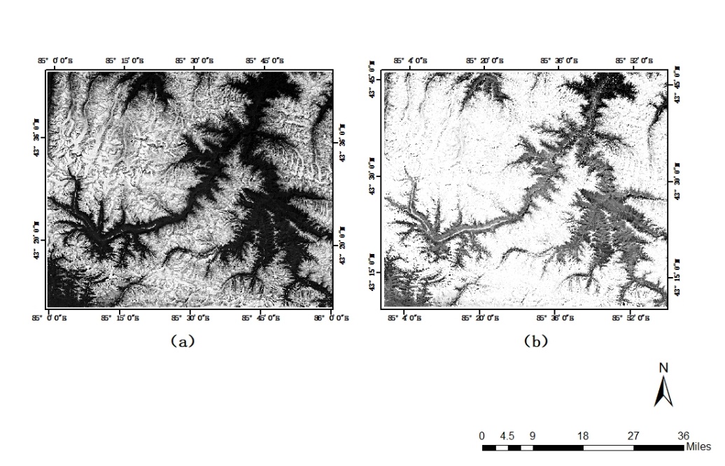
2.3 图像预处理 9
2.3.1 辐射定标 9
2.3.2 大气纠正 10
2.3.3 几何精校正 11
2.3.4 地形校正 11
第三章 积雪类型精细分类 13
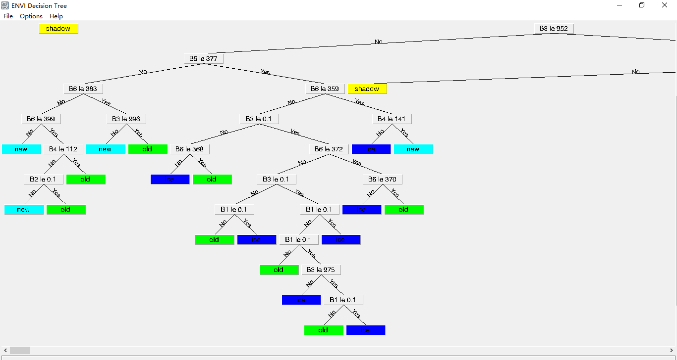
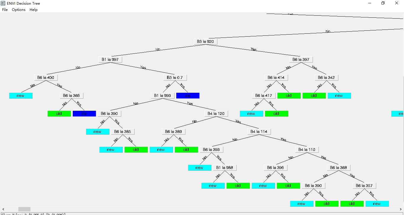
3.1 CART决策树算法 13
3.1.1 监督分类 13
3.1.2 基于CART算法的决策树 13
3.2 分类指标选择 14
3.2.1 波段化指标及NDSI图像生成 14
3.2.2 可见光波段反射率 15
3.2.3 NIR、SWIR波段反射率 16
3.3 基于光谱特征的分类规则获取 16
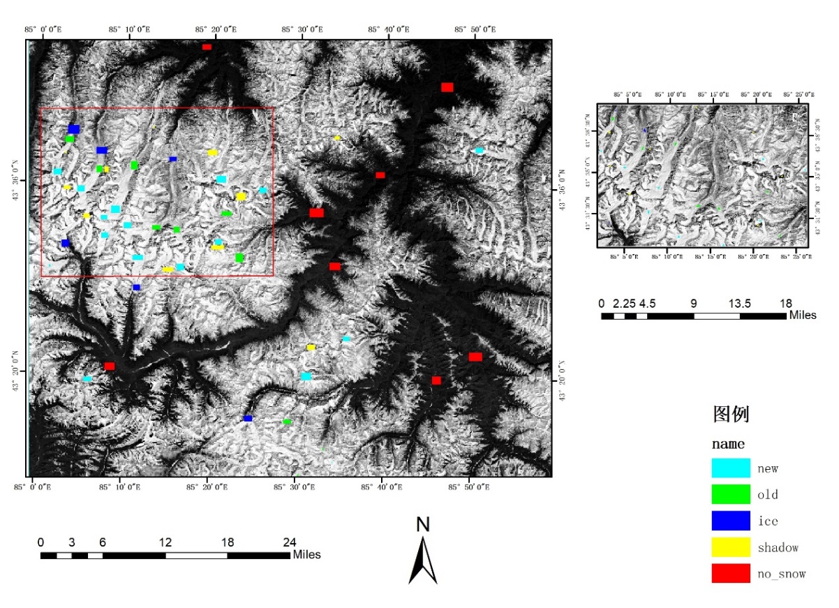
3.3.1 分类体系构建 16
3.3.2 样本选择依据 17
3.4 CART决策树生成 18
第四章 分类结果评估与分析 19
4.1 精度评估 19
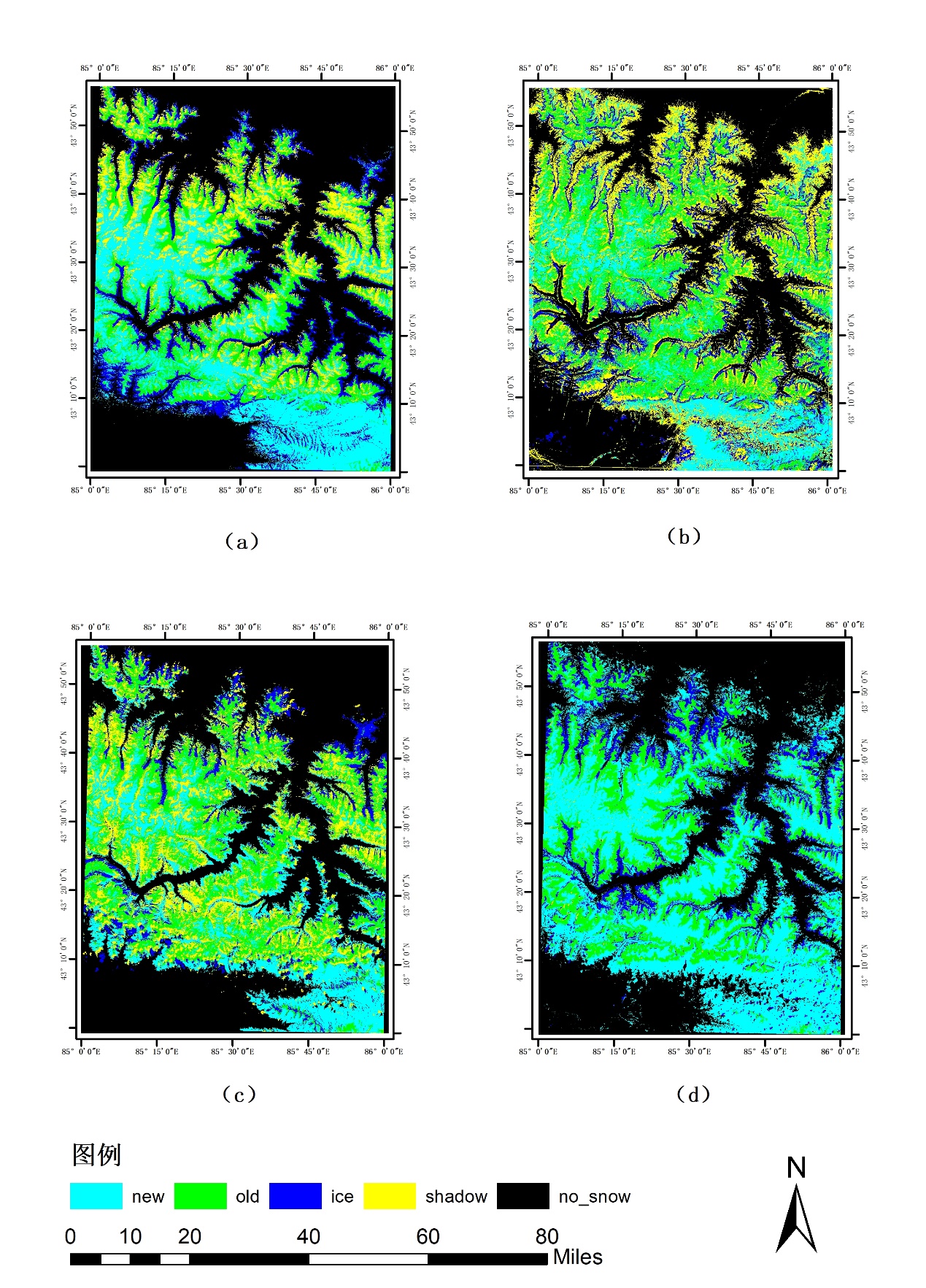
4.2 积雪类别特征分析 20
4.3 多时相积雪类别变化分析 24
4.3.1 面积分类结果 24
4.3.2 异常分析 25
第五章 结论与展望 27
参考文献 29
致 谢 31
第一章 引言
1.1 研究背景与依据
积雪是指由降雪形成的覆盖在地球表面上的雪层,它是地面气温低于冰点的寒冷地区或寒冷季节的特殊自然景观和天气现象[1]。积雪是全球变化的一项极为重要的指标,是一个研究全球气候变化的关键变量,它对于气候系统也有着显著的影响。积雪也是非常重要的淡水资源,是我国主要的河流补给,积雪各项指标的分析也为不同领域的研究提供了数据支持。
传统的积雪分类仅仅只有积雪和非积雪两类,没有考虑积雪和非积雪中间的过渡类型,这会给积雪检测带来较大的误差[2]。因此,对积雪缺失过渡类型问题的改进,制作更为精准的积雪/雪盖分类专题图,并能够为有需求的科学研究提供数据支持,对积雪的特征信息库补充、气候变化的研究、水文水资源管理以及积雪灾害研究预测预警等都是十分重要的。
以上是毕业论文大纲或资料介绍,该课题完整毕业论文、开题报告、任务书、程序设计、图纸设计等资料请添加微信获取,微信号:bysjorg。
相关图片展示: